 |
Mesquite, Nevada |
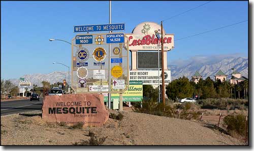
 Entering Mesquite from the south |
|
Mesquite is located on the I-15 right at the Arizona-Nevada State Line in the Virgin River Valley. Mesquite Flats was settled by Mormon pioneers. It took them 3 tries to get it right: their settlements kept getting flooded by the Virgin River. Later on they shortened the name to Mesquite. Like nearby Bunkerville, Mesquite was basically a farming area for many years. The Peppermill Resort & Casino opened in the 1970's and that was the first step in diversifying Mesquite's economy. Other casino resorts started to open in the mid 1990's, marketing Mesquite as a getaway from Las Vegas with a more laid-back scene. With the booming growth of Las Vegas and nearby St. George, Utah, Mesquite is growing from the "spill-over" effect. |
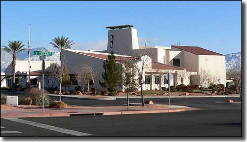
 Mesquite City Hall |
| Fast Facts about Mesquite, Nevada |
|
Mesquite, Clark County, NV 89024, 89027
Incorporated: May 1984 Elevation: 1,601' Latitude: 36.8026°N Longitude: 114.0822°W Resident Racial Breakdown: White Non-Hispanic: 71.5% Hispanic: 24.8% African-American: 0.6% Native American: 1.6% Other: 14.6% Two or More Races: 2.2% Education: High School or Higher: 77.3% Bachelor's Degree or Higher: 14.6% Graduate or Professional Degree: 5.3% 2009 Estimates: Population: 17,209 Males: 8,764 Females: 8,445 Median Resident Age: 39.5 Years Estimated Median Household Income: $51,328 Estimated Median Home Value: $261,310 Population Density: 1,124 People per Square Mile 2009 Cost of Living Index for Mesquite: 91.5 Major Industries: Entertainment & Recreation, Lodging & Food Services, Construction, Educational Services, Waste Management Services, Professional Services, Government, Finance & Insurance Services, Health Care, Social Services Unemployed: 6.6% |
|
|
Clark County Related Pages
Boulder City - Henderson - Las Vegas - Laughlin
North Las Vegas - Clark County Old Las Vegas Mormon State Historic Park - Valley of Fire State Park - Big Bend of the Colorado Recreation Area Spring Mountain Ranch State Park - Las Vegas Ski & Snowboard Resort Other Clark County Related Pages
Lake Mead National Recreation Area - Humboldt-Toiyabe National Forest
Red Rock Canyon Scenic Byway - Valley of Fire Scenic Byway Mt. Charleston Scenic Byway - Bitter Springs Back County Byway Gold Butte Back Country Byway - Desert National Wildlife Refuge Black Canyon of the Colorado Wilderness - Bridge Canyon Wilderness Eldorado Mountains Wilderness - Ireteba Peaks Wilderness- Jimbilnan Wilderness La Madre Mountain Wilderness - Mount Charleston Wilderness - Nellis Wash Wilderness Pinto Valley Wilderness - Rainbow Mountain Wilderness - Spirit Mountain Wilderness Jumbo Springs Wilderness - Lime Canyon Wilderness - Wee Thump Wilderness North McCullough Mountains Wilderness - South McCullough Mountains Wilderness Nevada Pages |
 |
| Index - Arizona - Colorado - Idaho - Montana - Nevada - New Mexico - Utah - Wyoming National Forests - National Parks - Scenic Byways - Ski & Snowboard Areas - BLM Sites Wilderness Areas - National Wildlife Refuges - National Trails - Rural Life Advertise With Us - About This Site - Privacy Policy |
| Photos of Mesquite entry sign and Mesquite City Hall courtesy of Stan Shebs, CCA ShareAlike 3.0 License. Text Copyright © by Sangres.com. All rights reserved. |