Datil, New Mexico

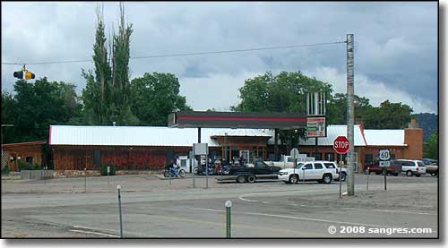
Downtown Datil, at the intersection of NM 12 and US 60
In 1885, the Magdalena Livestock Driveway was established, connecting the Springerville, Arizona cattle ranches with the railroad head at Magdalena. 15 water wells were drilled along the way (about every 10 miles) to provide for the large number of cows and sheep that were driven over this route, in season. One of last remaining of those wells is still flowing water about 1 mile west of Datil at the Datil Well Recreation Area & Campground. I think the village of Datil first sprang up as a stagecoach stop along that original cattle road and the townsite became centered around the intersection of NM 12 and US 60.
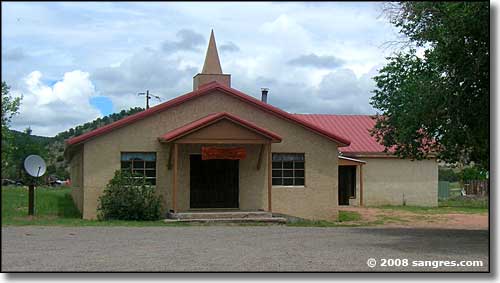
The present center of business is on the southwest corner of that crossroads. There's a convenience store, gas station, restaurant, and possibly motel (out behind the main building). Just to the west is a Forest Service office and an office for the Natural Resources Conservation Service. The former center of business (see bottom photo) is on the northwest corner of that same intersection.
Near Datil is where you'll find the Enchanted Tower: a rockclimbing hotspot. The tower is hidden behind a locked gate so you'll need a good map and the combination to the lock to go there...

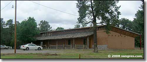
The only motel in town

The best-kept building in Datil

The former business district
Latitude: 34.144444°N
Longitude: 107.844167°W
Unincororated Community
Forest Products
Farming
Ranching
Tourism
Population Demographics: 2010
| Total Population | 54 |
| Males | 27 |
| Females | 27 |
| Population by Age | |
| Under 18 | 6 |
| 18 & over | 48 |
| 20-24 | 1 |
| 25-34 | 8 |
| 35-49 | 4 |
| 50-64 | 17 |
| 65 & over | 18 |
| Population by Ethnicity | |
| Hispanic or Latino | 8 |
| Non Hispanic or Latino | 46 |
| Population by Race | |
| White | 46 |
| African-American | 1 |
| Asian | 0 |
| Native American | 4 |
| Hawaiian or Pacific Islander | 0 |
| Other | 2 |
| Two or more | 1 |
