Willard, Utah

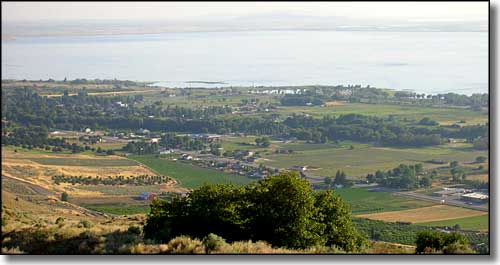
Looking across Willard to Willard Bay
Willard was first settled in 1851 by a group of pioneers of Scottish, Dutch, English and Welsh descent. The site was soon platted and had a fort wall built around it to protect the settlers from Indian attacks. At first the settlement was known as North Willow Creek but was renamed Willard in 1859, in honor of Willard Richards, a recently deceased counselor to Brigham Young and an Apostle of the LDS Church.
Most of the first settlers were farmers but some were blacksmiths, carpenters, school teachers and merchants. Many of them were also musicians. There was also an exceptionally gifted stone mason named Shadrack Jones and some of his work can still be seen in some of the more than 30 existing stone pioneer's homes.
Willard built its own powerhouse in the early 1900's and the town was electrified quickly. The community water system was in place by 1912. Historically, the local economy was based on agriculture, primarily the production of fruit. Highway 89 through Willard is still known as northern Utah's "fruitway," but these days, many of Willard's residents commute to other places to work.
Willard is located at the foot of Willard Peak (9,764') on an alluvial fan left behind as the waters of ancient Lake Bonneville receded. Willard was the site of regular flooding until the CCC built a dike and spillway in the 1930's to alleviate some of the causes. They also terraced the hills in the upper basin of Willard Canyon. The Willard City/Box Elder County Drainage and Flood Control District also built several reservoirs and pipelines to help reduce the flood problem. All of the water drains into Willard Bay, a fresh-water section of Great Salt Lake that is separated from the bigger lake by a long causeway/dam.

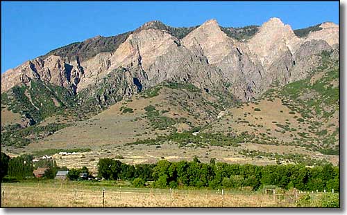
The Wellsville Mountains east of Willard
Latitude: 41.4121°N
Longitude: 112.0397°W
Elevation: 4,350'
Education:
High School or Higher: 88.5%
Bachelor's Degree or Higher: 14.5%
Graduate or Professional Degree: 4.7%
2011 Cost of Living Index for Willard: 84.6
Median Resident Age: 32.8 Years
Estimated Median Household Income: $59,500
Estimated Median Home Value: $188,900
Population Density: 312 People per Square Mile
Major Industries:
Government, Construction, Educational Services, Transportation Equipment, Lodging & Food Services, Agriculture, Computer & Electronic Products, Retail Services
Unemployed (March 2011): 9.6%
Population Demographics: 2010
| Total Population | 1,772 |
| Males | 878 |
| Females | 894 |
| Population by Age | |
| Under 18 | 512 |
| 18 & over | 1,260 |
| 20-24 | 86 |
| 25-34 | 241 |
| 35-49 | 296 |
| 50-64 | 367 |
| 65 & over | 213 |
| Population by Ethnicity | |
| Hispanic or Latino | 69 |
| Non Hispanic or Latino | 1,703 |
| Population by Race | |
| White | 1,691 |
| African-American | 1 |
| Asian | 14 |
| Native American | 6 |
| Hawaiian or Pacific Islander | 2 |
| Other | 21 |
| Two or more | 37 |
