
Fairplay, Colorado
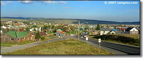
Looking over Fairplay from the northwest
Fairplay was founded in 1859 by gold prospectors who'd been driven from nearby Tarryall. The miners at Tarryall had staked more claims than they could possibly work but they wouldn't give up anything to the newcomers and chased them all away. Fairplay got its name from these new prospectors who were willing to guarantee that any newcomer would "get a Fair Play" there. In the end, Tarryall is gone and Fairplay is still here, a thriving community built at almost 10,000 feet in elevation.
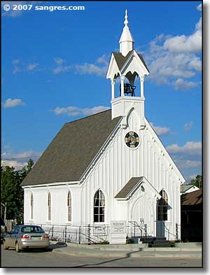
The church pictured to the left was built in 1874, as was the old courthouse pictured below. Fairplay is filled with historic buildings from the period including the reconstructed town of South Park City.
There is a photo below of a lake on the outskirts of Fairplay. That lake was probably created by the action of mining dredges working their way through the streambed gravels of the South Platte River. All around Fairplay and up into the mountains around Alma you can see the mounds and ridges of gravel that was dug up, sifted through for the gold and silver content and then dumped along the way. During the Great Depression there was a large influx of the unemployed who came to work over the remains of many of the old mines and tailings dumps. Every time there is a major upswing in global mineral prices the area sees new businesses coming in to rework the old mines and try to search out new mineral finds. Mining is still a major employer here but tourism has become the primary money-maker.
During the last weekend of July, Fairplay hosts the "Burro Days" Festival, an event that commemorates the area's mining heritage. A 29-mile burro race (one person, one burro) from Fairplay to the 13,000-foot summit of Mosquito Pass is the main event of the festival. The 1st prize is $1,000 and takes about 5 hours to complete.
West of Fairplay is Mt. Sherman (14,036'), to the northwest is Mt. Democrat (14,148'), Mt. Bross (14,172'), Mt. Cameron (14,239') and Mt. Lincoln (14,286'), and to the north is Mt. Silverheels (13,822').
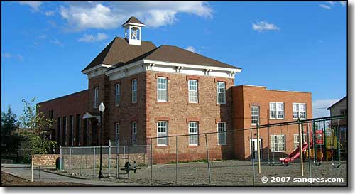
The old Fairplay School
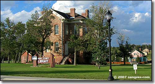
The old Park County Courthouse, now the Park County Library
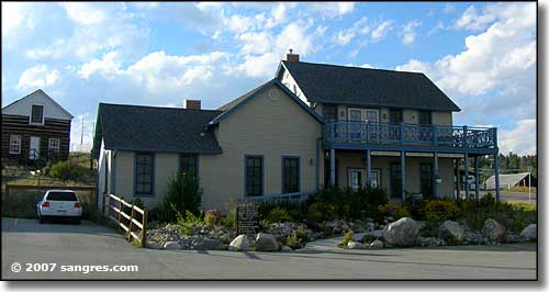
The Fairplay Welcome Center
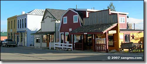
Part of original Fairplay
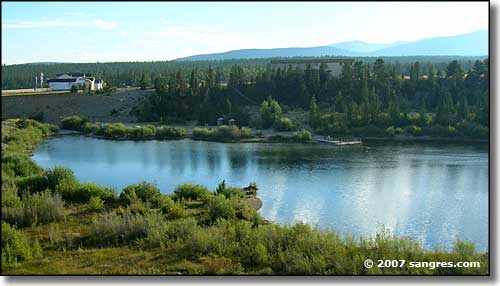
This lake is on the South Platte River at the edge of Fairplay
Latitude: 39.2244°N
Longitude: 105.9981°W
Incorporated: November 15, 1872
Elevation: 9,953'
Education:
High School or Higher: 88.2%
Bachelor's Degree or Higher: 23.8%
Graduate or Professional Degree: 7.3%
2011 Cost of Living Index for Fairplay: 94.4
Estimated Median Household Income: $50,200
Estimated Median Home Value: $162,000
Median Resident Age: 35.1 Years
Major Industries:
Lodging & Food Services, Construction, Government, Educational Services, Health Care, Professional Services, Agriculture, Finance & Insurance Services
Unemployed (March 2011): 9.3%
Population Demographics: 2010
| Total Population | 679 |
| Males | 369 |
| Females | 310 |
| Population by Age | |
| Under 18 | 174 |
| 18 & over | 505 |
| 20-24 | 20 |
| 25-34 | 93 |
| 35-49 | 182 |
| 50-64 | 147 |
| 65 & over | 51 |
| Population by Ethnicity | |
| Hispanic or Latino | 41 |
| Non Hispanic or Latino | 638 |
| Population by Race | |
| White | 629 |
| African-American | 5 |
| Asian | 3 |
| Native American | 7 |
| Hawaiian or Pacific Islander | 0 |
| Other | 9 |
| Two or more | 26 |
Pike National Forest - Eleven Mile State Park - Spinney Mountain State Park
South Park City - Hoosier Pass - State Trust Lands & Wildlife Areas
National Park Service Sites - BLM Sites - National Wilderness Areas - Unique Natural Features
Outdoor Sports & Recreation - Ski & Snowboard Areas - Photo Galleries - Colorado Mountains
