Naat'tsis'aan-Navajo Mountain Scenic Road

Naat'tsis'aan - Navajo Mountain
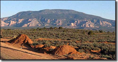
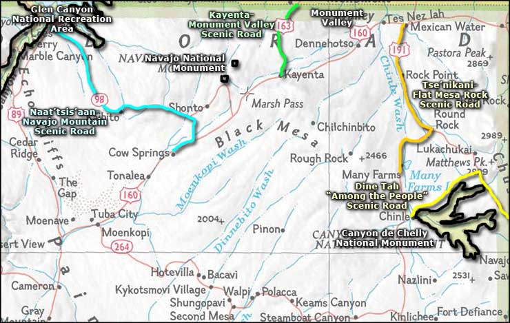
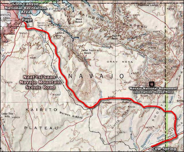
The Naat'tsis'aan-Navajo Mountain Scenic Road runs for 66 miles northwesterly across the Navajo Nation, one end near Cow Springs, the other in Page (above Lake Powell and the Glen Canyon National Recreation Area). Just out of Cow Springs you're going to turn off US Highway 160 and head northwest. You'll cross the railroad tracks and then drop into the Kletha Valley. This is an area of desert grasslands separated by rocky arroyos and rippled sandstone rises. There are a lot of horses hiding out in the rolling pastures in this area, the Navajo have a long tradition of being excellent horsemen and this is where most of the tribe's horses are.
Then you'll come to the foot of Navajo Mountain, and turn west around it. A few more miles will bring you to the area of Kaibito, a tiny settlement with a general store and little else, about 1/2 mile off the pavement. The area around Kaibito was used by the Navajos extensively (for hiding purposes) in 1863-1864 while the Kit Carson campaign was rounding up tribespeople and sending them walking eastward to Bosque Redondo in New Mexico. Beyond Kaibito, you'll be taking a route down to Page that parallels the old trackbed of the Black Mesa & Lake Powell Railroad. This is a zone of more sandstone formations: bluffs, walls, spires and hoodoos. The flat surfaces sport small sand dunes and isolated grasslands with stands of yucca, cholla and prickly pear common.
Navajo Mountain will dwindle away behind you, you'll pass the 900' walls of Leche-e Rock, then come to the Navajo Generating Station: a multi-megawatt, coal-burning power plant just east of Page. In the distance, you'll see Lake Powell and you'll be able to watch as Lake Powell draws continually closer, until the road ends at a T-intersection with US Highway 89 in Page. There are many times during the year when you can drive this road and have the entire road to yourself...

Naat'tsisaan-Navajo Mountain Scenic Road area map

Naat'tsisaan-Navajo Mountain Scenic Road close-up
